Interlaken is the central hub of the Bernese Oberland, a remarkable Swiss landscape of snow-capped mountains and deep sided valleys. Here are the best hikes near Interlaken including maps and trail tips.
By: Mark Barnes |
Published: 3 Apr 2024
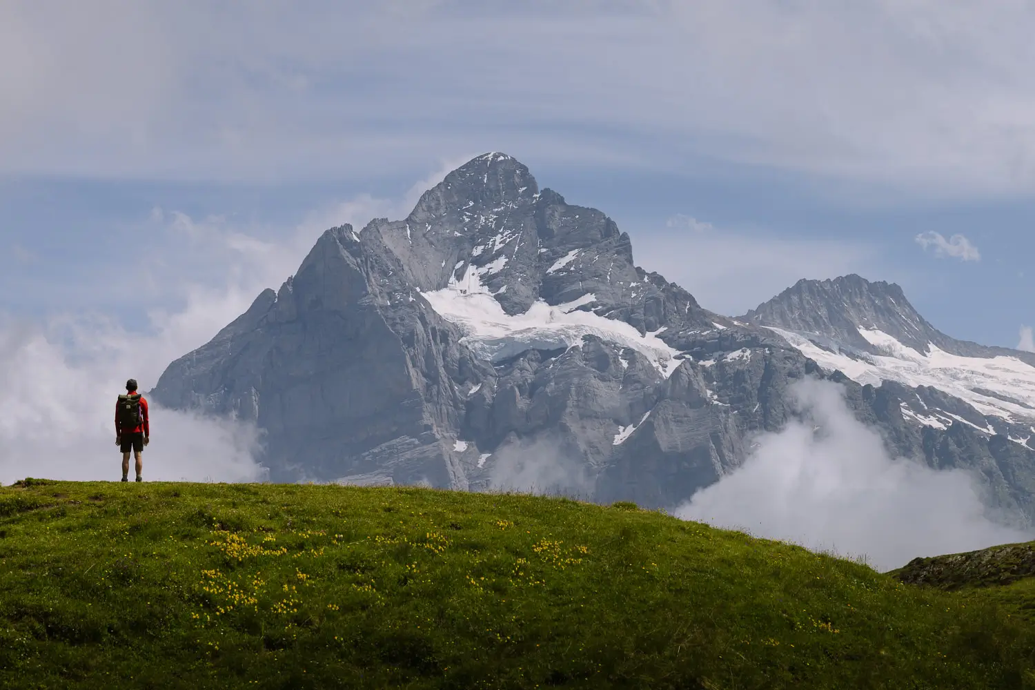
The Bernese Oberland is quintessential Switzerland.
Snow-capped mountains overlook grassy meadows dotted with alpine flowers and picture-perfect wooden chalets. Plunging waterfalls cut steep-sided valleys, and turquoise lakes reflect rugged rock faces.
It’s one of the most beautiful places to visit in Switzerland.
At its centre is Interlaken. With a myriad of cable cars and trains connecting a maze of trails, its the perfect base for hiking in the region. Enjoy an easy stroll with picturesque views, or a challenging hike along precarious ridges.
Experience the majesty of snow-covered Jungfraujoch. Be engrossed in the valley of 72 waterfalls. Stare at the imposing facades of the Eiger, Mönch, and Aletschhorn mountains.
These are our top hikes near Interlaken organised via easy, medium and challenging treks. We have included maps, route instructions, and tips for getting that perfect photo.


WHERE IS INTERLAKEN?
Interlaken is the central hub of the Bernese Oberland, a mountainous region of Switzerland. It it located southeast of the Swiss capital of Bern .
The region is home to some of the most dramatic mountain scenery in Europe, including many of the highest peaks in the Alps. There are 9, 4,000-metre peaks in the Berner Oberland.
The most famous peaks over 4,000 metres are:
- Finsteraarhorn (4,274m)
- Mönch (4,107m)
- Jungfrau (4,158m)
- Aletschhorn (4,193m)
Other highlights include the Lauterbrunnen Valley and the turquoise lakes of Brienz and Thun. There are also charming villages including Grindelwald, Interlaken, and Mürren.
Interlaken is the most convenient place to stay to get to the best hiking trails.

MAP | BEST HIKES NEAR INTERLAKEN
The below map contains each of the routes for our favourite hikes in the Bernese Oberland. Each hike is colour coded. All the details are included in the descriptions further down in this guide.
How to use this map / Click on the top left of the map to display the list of locations, then click on the locations to display further information. Click on the top right corner of the map to open a larger version in a new tab or the star to save to your Google Maps.
EASY HIKES NEAR INTERLAKEN
Our 5 easy hikes in the Bernese Oberland are under 7 kilometres and can be done in less than 2 hours and 15 minutes. They have relatively little uphill with an ascent of no more than 150 metres.

MODERATE HIKES NEAR INTERLAKEN
Our 6 moderate walks are up to 9 kilometres long and require a bit more ascent or descent or walking through snow. They take between 2 hours and 4 hours to complete and are more physically demanding.

CHALLENGING HIKES NEAR INTERLAKEN
Our 4 challenging hikes are all over 11 kilometres taking between 5 and 11 hours to complete. They have over 900 metres of ascent or descent and require a good level of fitness.
The Männlichen to Alpiglen hike is almost in the moderate section. The Hardnergrat should have its own ‘extremely’ challenging section.

1 – JUNGFRAU EIGER WALK
This is a great little trail to do on the way down from the Jungfraujoch. It only takes 30 minutes and it’s all downhill.
The hike begins at Eigergletscher Station. Take the train from Interlaken to Grindelwald and then hop on the new Eiger Express for a thrilling start to the hike. From the station, you can almost touch the tongues of snow and ice coming down the rocky faces of Mönch and Jungfrau.
The hike passes a charming wooden mountain hut that peers over the Lauterbrunnen Valley. Take a shot at the artificial lake of Fallbodensee, before making your way to Kleine Scheidegg.
At Kleine Scheidegg you can get the train back to Grindelwald or Lauterbrunnen and then onto Interlaken.
Tip | Keep an eye out for photo opportunities of the Jungfraujoch train as you walk down.
ROUTE DETAILS // JUNGFRAU EIGER
Distance – 2.5 kilometres (1.5 miles) | Time – 30 minutes | Elevation – 260 meters (850 feet) descent | Difficulty – Easy | Start – Eigergletscher | End – Kleine Scheidegg | Map – Peach trail


2 – GRÜTSCHALP TO MÜRREN
This easy trail ascends the balcony between Grütschalp and Mürren.
The path goes in and out of trees, revealing glimpses of the stunning Lauterbrunnen valley.
There are grand views across to the town of Wengen and up to the mighty Eiger, Mönch and Jungfrau mountains.
The walk ends in Mürren where car-free lanes are surrounded by cute wooden chalets.
Tip | This is an easy and pleasant walk, but you can also get many of the same views on the train that runs between Grütschalp and Mürren. So, you could save your energy for another hike.
ROUTE DETAILS // GRÜTSCHALP TO MÜRREN
Distance – 4.5 kilometres (2.8 miles) | Time – 1 hour and 30 minutes | Elevation – 150 metres (490 feet) ascent | Difficulty – Easy | Start – Grütschalp | End – Mürren | Map – Light grey trail


3 – MÄNNLICHEN PANORAMA TRAIL
The best of the easy hikes in the Bernese Oberland, the Männlichen Panorama Trail has magnificent views.
It starts at the Männlichen Cable Car Station, which has a perfect view of the Lauterbrunnen Valley and Staubbach Waterfall.
The trail heads towards Kleine Scheidegg with the trio of snow-capped giants – Eiger, Mönch, and Jungfrau in front of you. The town of Grindelwald is on your left.
The path is well-signed and very easy to follow. As you make progress, the 1,800m high daunting north face of the Eiger becomes more and more imposing.

Just before reaching Kleine Scheidegg stop at Restaurant Grindelwaldblick for a break. Head up to its watchtower for one of the most scenic views in Switzerland.
Tip | From Männlichen cable car an optional detour takes you to the Männlichen summit. The views from here are even better. It is a little higher, so it has a better angle looking down the Lauterbrunnen Valley. Add 500 metres each way and 120 metres of ascent and descent to include this detour.
ROUTE DETAILS // MÄNNLICHEN PANORAMA TRAIL
Distance – 4.6 kilometres (2.85 miles) | Time – 1 hour 30 minutes | Elevation – 160 metres (525 feet) descent | Difficulty – Easy | Start – Männlichen | End – Kleine Scheidegg | Map – Blue trail


4 – LAUTERBRUNNEN VALLEY WALK
The Lauterbrunnen Valley is possibly the most beautiful valley in Europe. Its sheer-sided walls are cut by 72 waterfalls, some of which drop up to 400 metres.
This easy hike follows the valley floor between Stechelberg and Lauterbrunnen. There is almost no ascent or descent making it a very pleasant stroll in pretty surroundings.
There are also two waterfalls worth making a detour to.
The first is Trümmelbach Falls (April to November 9 am to 5 pm), Europe’s largest subterranean waterfall carrying up to 20,000 litres of water per second.
Deep inside the valley walls the 10 roaring falls are accessible by a series of lifts, tunnels, and platforms. Allow 1 to 2 hours to explore the falls. Bring a raincoat and shoes with good grip.
The second is Staubbach Waterfall, a beautiful whisp of water dropping 297 metres. It’s the third-highest waterfall in the Lauterbrunnen Valley, and just a short detour from the path.
ROUTE DETAILS // LAUTERBRUNNEN VALLEY
Distance – 6.8 kilometres (4.25 miles) | Time – 2 hours | Elevation – 120 metres (395 feet) descent | Difficulty – Easy | Start – Stechelberg | End – Lauterbrunnen | Map – Green trail


5 – SCHYNIGE PLATTE PANORAMAWEG
This easy circular walk is a wonderful day out in the Alps.
Take the train from Interlaken to Wilderswil and then change onto the cogwheel train to Schynige Platte. Built in 1892, the vintage train with wooden carriages climbs 1,420 metres over 7.3 kilometres. Winding in an out of the trees, glimpses of 4,000-metre mountains flicker through the windows.
From Schynige Platte there are several well signed Panorama Trails of different lengths.
The one we have included on our map is the longest, but they all offer wonderful views. To the south are the high peaks of the Berner Oberland. To the north, the shimmering turquoise lakes of Lake Thun and Brienz, and Interlaken.
There’s a short 150 metre ascent between Schynige Platte and Daube. But the ridge walk from Daube past Oberberghorn towards Loucherhorn is easy and wonderful.
Tip | Sit on the right-hand side of the train for the best views.
ROUTE DETAILS // SCHYNIGE PLATTE PANORAMAWEG
Distance – 5.6 kilometres (3.7 miles) | Time – 2 hours and 15 minutes | Elevation – 150 metres (500 feet) ascent and descent | Difficulty – Easy to Moderate | Start & End: Shynige Platte | Map – Orange trail


6 – FIRST TO BACHALPSEE HIKE
This there-and-back hike has tremendous views over Bachalpsee Lake.
It begins at the top of the Grindelwald – First Cable Car Station where a viewing platform hangs over the Grindelwald Valley.
Next to the platform, the First Cliff Walk is a 300-metre metal walkway suspended on the side of the cliff. You can skip it, but it does mark a dramatic start to the walk.
The wide, easy-to-follow trail, now slowly heads up to Bachalpsee Lake. This is one of the most popular hikes near Interlaken, so you won’t have the trail to yourself. But the lake backed by the triangular shape of Wetterhorn, is one of the finest photo opportunities in the region.
After visiting the lake, return to First where there are several great family-friendly activities to finish the hike.
- First Flyer is a zipline down to Schreckfeld Cable Car Station.
- First Glider drags you backwards from Schreckfeld and then glides you back down at 83 kilometres per hour.
- First Mountain Car are 3-wheel carts that you can ride between Schreckfeld and Bort.
- First Trottibike is a scooter run between Bort and Grindelwald.
Tip | If it’s a warm day bring your swimming gear to take a dip in the lake.
ROUTE DETAILS // FIRST TO BACHALPSEE
Distance – 6 kilometres (3.75 miles) | Time – 2 hours and 30 minutes (round trip) | Elevation – 200 metres (650 feet) ascent and descent | Difficulty – Easy to Moderate | Start & End – First | Map – Yellow trail


7 – NORTH FACE TRAIL
This hike can be completed in either direction.
Going downhill from Allmendhubel to Mürren we would rank it as easy. Going uphill from Mürren to Allmendhubel we’d call it moderate.
Either way, the trail is well-signed. Simply follow the blue ‘North Face-Trail’ markers at each junction.
The trail is a great exploration of grassy meadows dotted with cute wooden chalets. Cows, pigs, goats, and horses dot the landscape as the path meanders past rustic barns and working farms.
There are grand views up to the Schilthorn and across the upper end of the Lauterbrunnen Valley.
Allmendhubel has a restaurant and play area. Mürren, perched on the edge of a vertical cliff is one of the more enchanting villages in Switzerland.
ROUTE DETAILS // NORTH FACE
Distance – 6.5 kilometres (4 miles) | Time – 2 hour 30 minutes | Elevation – 390 metres (1,280 feet) ascent and 60 metres (200 feet) descent | Difficulty – Easy to Moderate | Start – Allmendhubel | End – Mürren | Map – Brown trail


8 – MÖNCHSJOCHHÜTTE
One of the best things to do at the Jungfraujoch is to hike to Mönchsjoch Hut. The highest altitude serviced hut in Switzerland, it stands at a staggering 3,658 metres.
All year round, snow and ice surround the rocky pinnacle on which it stands.
Fortunately, it’s only 1.5 miles from the Jungfraujoch Observation Deck at 3,463m. However, hiking through snow at high altitudes often takes longer than you think. We’d recommend allowing 2 hours for the round trip.
Warm up with a coffee at Mönchsjoch Hut.


A few suggestions for this hike:
- The high-altitude trail can often be closed so check before you leave.
- It’s very cold at the summit of this hike, (zero degrees even in peak summer) so bring warm clothes and waterproof boots.
- It can also be very sunny and the reflection off the snow can be blinding so don’t forget your sunglasses and sunblock.
- No mountaineering skills are required, it’s just a simple walk-through snow.
Our Recommendation | This is a great hike to do if you already plan on taking the train up the Jungfraujoch. However, the train is very expensive, and it’s not worth paying for it, just to do the hike.
ROUTE DETAILS // MÖNCHSJOCHHÜTTE
Distance – 4 kilometres (2.5 miles) | Time – 2 hours | Elevation – 210 metres (690 feet) ascent and descent | Difficulty – Moderate | Start & End – Jungfraujoch | Map – Black trail

9 – NIEDERHORN RIDGE HIKE
All the best hikes in the Bernese Oberland listed so far are in the Jungfrau region between Grindelwald, Mürren, and Interlaken.
This hike explores a different part of the region: the ridges to the north of Interlaken with wonderful views over Lake Thun.
Start by taking the Beatenberg Cable Car up to the Niederhorn Cable Car Station and head to the far side of the restaurant to soak in the views of the lake. If you are lucky, paragliders and hang gliders will be hurling themselves from the summit.
Next head along a magnificent ridge to Burgfeldstand for fine views down into the valley. Then double back and follow the trail through the trees to Vorass.
It’s a good hike if you like wildlife with chances of spotting ibexes, marmots, and even the occasional chamois.
From Vorass take the cable car back down to Beatenberg.
Although this hike came highly recommended to us, bad weather meant we could not complete it on our last visit. We are saving it for next time.
ROUTE DETAILS // NIEDERHORN RIDGE
Distance – 7.2 kilometres (4.5 miles) | Time – 3 hours | Elevation – 110 metres (360 feet) ascent and 480 meters (1,575 feet) descent | Difficulty – Moderate | Start – Niederhorn | End – Vorass | Map – Dark Blue trail


10 – EIGER TRAIL
The north face of the Eiger is infamous amongst mountaineers. Its 1,800-metre sheer face attracts climbers from all over the world.
The best way to get close to it and understand the challenge (without the risk) is to hike the Eiger Trail.
The path begins at Eigergletscher and heads between steep alpine meadows on one side and the scree slopes of the north face on the other. It’s a lovely narrow mountain trail making its way through grass and rock.
There’s nothing too challenging on route and the trail gradually descends.
The views don’t change too much as you are always facing the same way, but there’s something bewitching about walking under the sheer cliff face.
The hike ends at Alpiglen where a train can take you down to Grindelwald or up to Kleine Scheidegg.
ROUTE DETAILS // EIGER TRAIL
Distance – 6.15 kilometres (3.8 miles) | Time – 2 hour 30 minutes | Elevation – 80 metres (260 feet) ascent and 780 metres (2,550 feet) descent | Difficulty – Moderate | Start – Eigergletscher | End – Alpiglen | Map – Light green trail


11 – OESCHINEN LAKE PANORAMA TRAIL
Oeschinen Lake is one of the most beautiful in Switzerland.
Blue-green waters are surrounded by 3,500-metre-high jagged peaks that rise from its shores. The entire area looks like a massive cauldron of ice and rock. When the sun is shining, its turquoise waters appear incandescent.
A trail called the Panoramaweg winds its way above the lake providing breath-taking views.
The hike can be undertaken by anyone with a reasonable level of fitness and the trail is easy to follow and well signed.
Although it’s a little out of the way, it’s worth the effort to get there.
You can read all about it in our Oeschinen Lake Panoramaweg guide.
ROUTE DETAILS // OESCHINEN LAKE
Distance – 8.5 kilometres (5.25 miles) | Time – 3 hours and 45 minutes | Elevation – 420 metres (1,375 feet) ascent and descent | Difficulty – Moderate | Start & End – Oeschinen Cable Car Station | Map – Aubergine trail


12 – MÄNNLICHEN TO ALPIGLEN HIKE
This wonderful hike combines three shorter trails and collects many of the best views of the Berner Oberland region.
It begins at the Männlichen Cable Car Station. From here, you can take an optional detour to the top of Männlichen for excellent views of the Lauterbrunnen Valley.
Next, the trail follows the Männlichen Panoramaweg. This path traverses under the ridgeline towards Kleine Scheidegg. Glorious views of the three mighty peaks of Eiger, Mönch, and Jungfrau tower in front of you.
At Kleine Scheidegg the path follows the Jungfrau Walk, climbing up to Eigergletscher.
From here it follows the Eiger Trail, which traverses under the mighty north face of the Eiger.


It ends at Alpiglen Train Station where you can return to most destinations in the Berner Oberland region.
There is nothing technically difficult on this walk and all the trails are well signed. Restaurant Grindelwaldblick is our choice for lunch. It has a little watchtower to catch the best of the views.
ROUTE DETAILS // MÄNNLICHEN TO ALPIGLEN
Distance – 13.25 km (8.25 miles) | Time – 5 hours | Elevation – 340 metres (1,115 feet) ascent and 945 metres (3,100 feet) descent | Difficulty – Moderate | Start – Männlichen | End – Alpiglen | Map – Blue, peach, and light green trails


13 – SCHILTHORN TO MÜRREN HIKE
This hike starts from Piz Gloria Cable Car Station at the top of the Schilthorn. The rotating restaurant with 360-degree views featured in the James Bond film, On Her Majesty’s Secret Service.
The first hour of this hike is a lovely walk along a wild rocky ridge.
Although it has steep drops on either side, the path is wide and not too exposed. There are a couple of metal ladders and handrails to assist and often large piles of rocks to protect you on one side.
At the end of the ridge, the path drops steeply down the flanks of the mountain. This is a long 1,000-metre descent. The rocky trail gradually turns to grassy meadows dotted with alpine flowers. The mountains of the Berner Oberland spread out in front.
The trail can be tricky to spot in places so make sure you keep referring to the map.
About 90 minutes after leaving the ridge, the trail reaches Rotstochhütte, a perfect spot to stop for lunch.
From here it’s just over 2 hours and 400 additional metres of descent back to Mürren. The last part of the trail is part of the North Face Trail.
It’s a challenging hike that takes about 5 hours walking, but you’ll want to leave at least 6 hours for lunch and photos.
ROUTE DETAILS // SCHILTHORN TO MÜRREN
Distance – 11 kilometres (6.8 miles) | Time – 5 hours | Elevation – 1,400 metres (4,600 feet) descent | Difficulty – Moderate to Challenging | Start – Schilthorn | End – Mürren | Map – Dark grey trail


14 – SCHYNIGE PLATTE TO FIRST HIKE
If we had to choose one walk as the best hike in Switzerland, this would be it.
It combines two popular walks, the Schynige Platte Panoramaweg and Faulhornweg. Along the way you’ll encounter grand views of 4,000-metre peaks, turquoise lakes, a lofty summit, a hanging walkway, and a charming mountain hut.
The hike begins at the Schynige Platte Cog Railway Station. The trail follows the Panoramaweg towards Daube and Oberberghorn with wonderful views down to Interlaken and Lake Brienz.
At Loucheron the Panoramaweg meets up with the Faulhornweg and starts to climb.


The trail winds past a massif cliff face to reach Männdelen Hut. From here, the walk contours under the mountaintop before suddenly appearing on the ridgeline. Magnificent views of multiple 4,000-metre peaks dominate the skyline.
A stiff climb brings you to the top of Faulhorn (2,681m), where a charming hut is the ideal place to stop for lunch. It’s now a gradual descent to Bachalpsee then onto First.
The day ends with a scenic ride on the Grindelwald-First cable car to Grindelwald and then the train back to Interlaken.
There is nothing technically difficult on this trail, but it’s considered challenging because of the distance, and the total ascent of 1,000 metres.
Tip | Get one of the first two trains to Schynige Platte to allow plenty of time.
ROUTE DETAILS // SHYNIGE PLATTE TO FIRST
Distance – 16.5 kilometres (10.25 miles) | Time – 7 hours | Elevation – 940 metres (3,080 feet) ascent and 740 metres (2,430) descent | Difficulty – Challenging | Start – Shynige Platte | End – First | Map – Orange, red, and yellow trails


15 – HARDNERGRAT OR BRIENZERGRAT
This challenging hike is 13 miles with over 9,000 feet of total elevation change. Additionally, close to half of the distance is on a very narrow ridge.
It should only be undertaken by very fit people, with plenty of walking experience and no fear of heights. You should also only attempt it on dry, clear days.
The path runs along a thin ridge between the funicular at Harder Kulm (1,321m) with wonderful views down to Interlaken and Brienz Rothorn Cable Car & Train Station (2,350m). The best views are the area around Augstmatthorn (2,167m) where it’s possible to spot a colony of ibex.
If you undertake the walk from Harder Kulm to Rothorn, it is called the Hardnergrat. From Rothorn to Harder Kulm it’s called the Brienzergrat.

We suggest you do the Brienzergrat starting at Rothorn and ending at Harder Kulm for three reasons:
- The hardest and most interesting part of the walk is towards the Rothorn end, so if you decide the hike is not for you its shorter to turn round and head back.
- There is only 1,100m of ascent in the Brienzergrat direction, rather than 2,030m in the Hardnergrat direction.
- The Harder Kulm cable car stays open much later than the Brienz Rothorn cogwheel train, so you are not rushing as much to get the last cable car down.
We have not actually completed this hike. We took the cogwheel train from Brienz to Rothorn, but the cloud came over and the wind picked up, so we ended up coming back down.
Tip | Book a seat on the first train in the morning from Brienz to Rothorn. Trains leave one hour earlier on weekends than on weekdays. An extra hour to complete the walk might come in handy.
ROUTE DETAILS // BRIENZERGRAT
Distance – 20.4 kilometres (12.7 miles) | Time – 9 to 11 hours | Elevation – 1,100 metres (3,600 feet) ascent and 2030 metres (6,660) descent | Difficulty – Extremely Challenging | Start – Rothorn Train Station | End – Harder Kulm | Map – Purple trail


HIKES NOT TO MISS NEAR INTERLAKEN
Most people only spend three or four days in the Bernese Oberland and cannot hope to complete all the hikes in that time. So, here are our favourite Interlaken hikes which we suggest you don’t miss.
- Best Easy Hike – Männlichen Panorama Trail
- Best Moderate Hike – Oeschinen Lake Panorama Trail
- Best Challenging Hike – Shynige Platte to First Hike
HOW MANY DAYS HIKING IN BERNESE OBERLAND?
We recommend spending at least three full days in the Bernese Oberland. This gives you enough time to explore the different areas and complete the three best hikes.
- Day 1 – Hike from Shynige Platte to First.
- Day 2 – Hike the Männlichen Panorama Trail combined with visiting either the Jungfraujoch and/or Mürren and the Lauterbrunnen Valley.
- Day 3 – Hike the Oeschinen Lake Panorama Trail.
You could easily spend five to seven days in the area, taking boats on the lakes, trying out the other hikes and visiting pretty villages.
BEST TIME TO HIKE IN BERNESE OBERLAND
September is the best time to hike in the Bernese Oberland.
The summer hiking season runs from mid-June to mid-October, but snow can still cover the higher trail early in the season.
The trails are at their most busy during the summer holidays from mid-July to the end of August. It’s a beautiful time to visit when the meadows are lush and the alpine flowers blooming. But you’ll rarely have a trail to yourself.


THANKS FOR VISITING // WHERE NEXT?
A BIG THANK YOU
We’ve been providing free travel content on Anywhere We Roam since 2017. If you appreciate what we do, here are some ways you can support us.
Thank you!
Paul & Mark
FOLLOW US ON INSTAGRAM
USE OUR RESOURCES PAGE